Pérez Zeledón, Costa Rica · sold by owner, no agents
Your own river.
Mountain views.
The groundwork done.
12,571 m² of titled land in San Ignacio de Cajón, plus your own registered 7 × 10⁷ m driveway. Private frontage on a clear mountain river, three cleared building pads, earthworks done and electricity at the gate.
01
This is the land
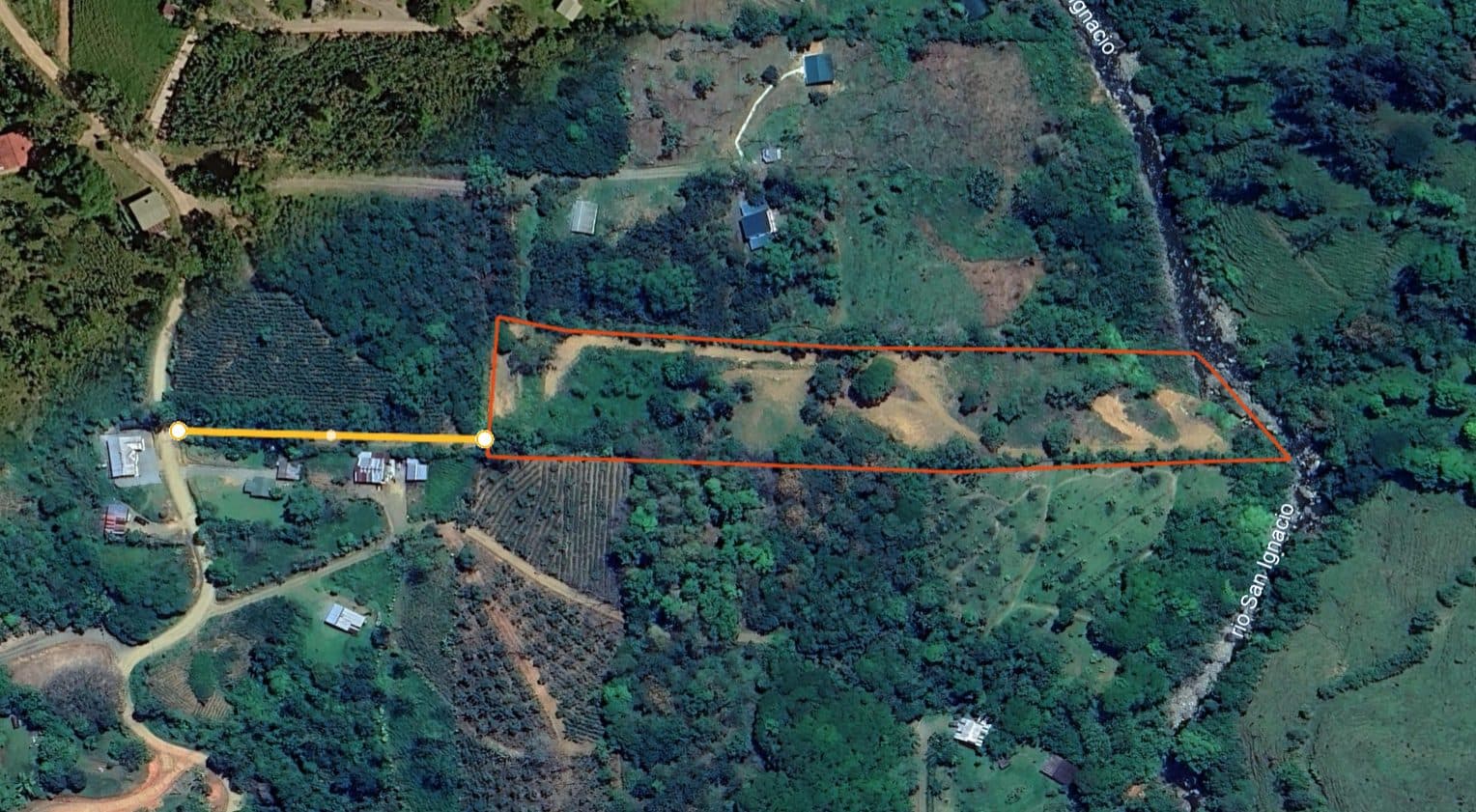
12,571 m² in one long parcel from the public road down to the river, plus your own registered 7 m × 107 m driveway strip (about 750 m²) with rights for access, water and electricity lines, a gate and planting.
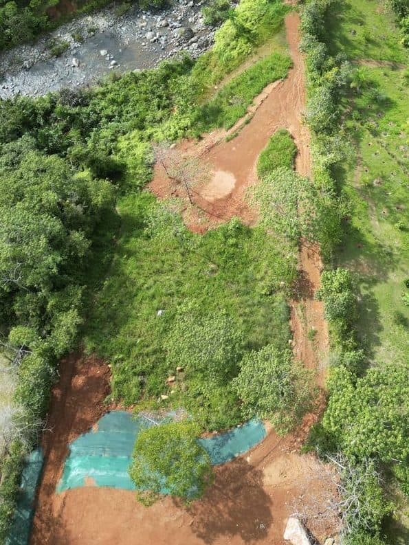 Drone view: river frontage, building pads and access road
Private riverfront land in the mountains of Pérez Zeledón
12,571 m² (1.26 ha / 3.1 acres) of titled land plus a registered 7 m × 107 m private driveway, with private frontage on a clear mountain river, mountain views, three cleared building pads and electricity at the gate, 30 minutes from San Isidro de El General.
A welcoming community of around 33 families, a settled mix of Costa Rican and international (North American, Canadian and European) residents. Minutes from the Hacienda AltaGracia resort. The area is steadily appreciating.
02 · River
The river
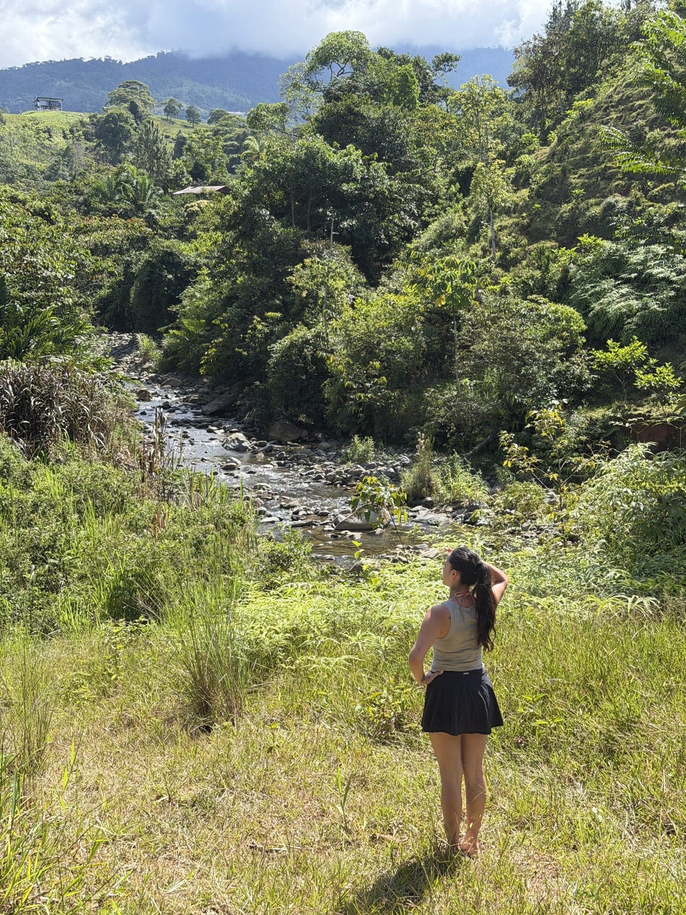
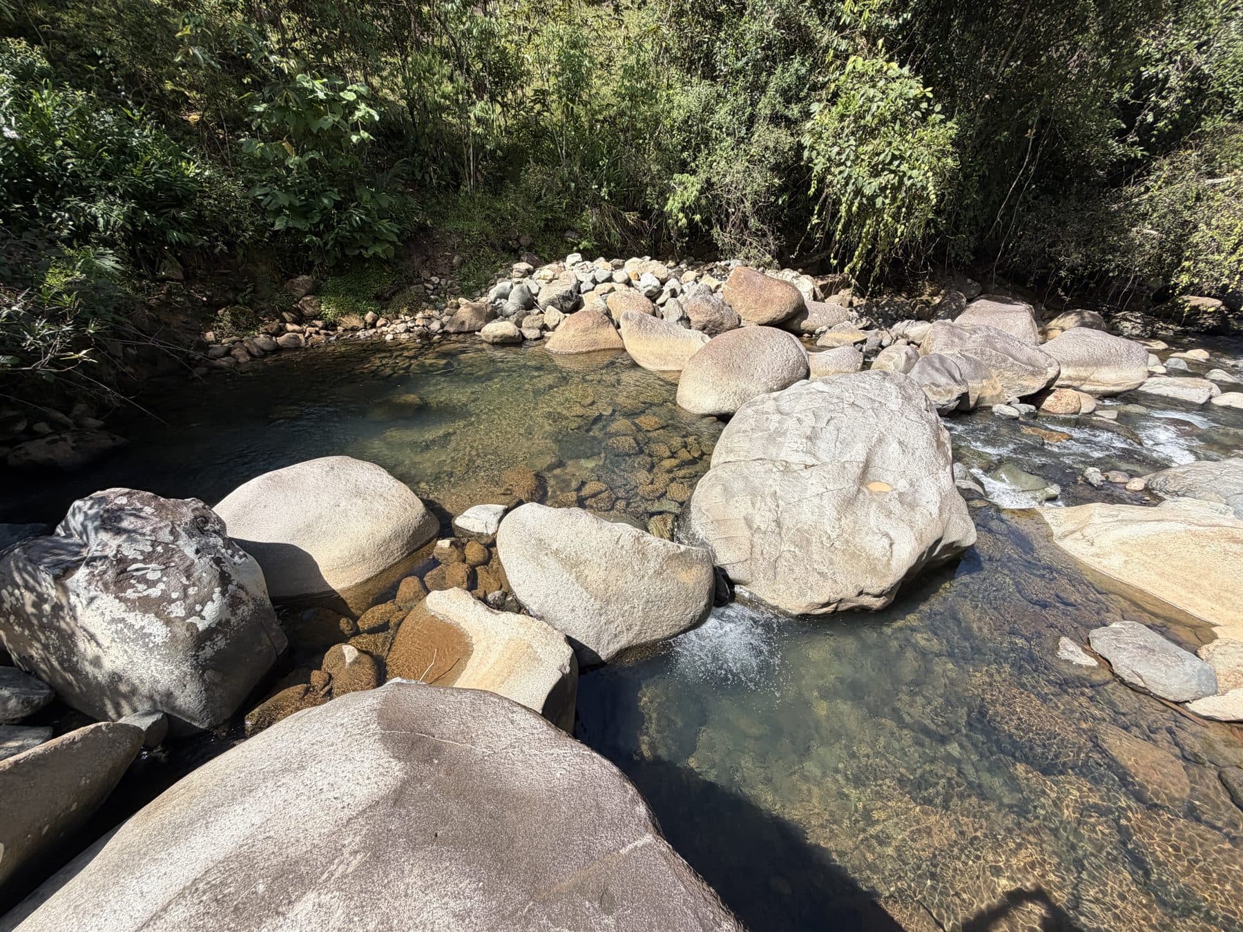 The river and a swimming poza (no building pad)
Clear, boulder-lined mountain river with a series of natural swimming pools. A swimming poza sits right on the property line, with more spectacular pools a short walk downstream. The far bank is farmland, so the river outlook is private and cannot be built out.
The building platforms sit well above the river and its protected margin, so they are not exposed to flooding, even in the rainy season.
What is yours, and what is downstream
Spot 1 is on the property. Spots 2 to 8 are public swimming spots further downstream, reached on foot along the river. They are not part of the land for sale, but they are your weekend.
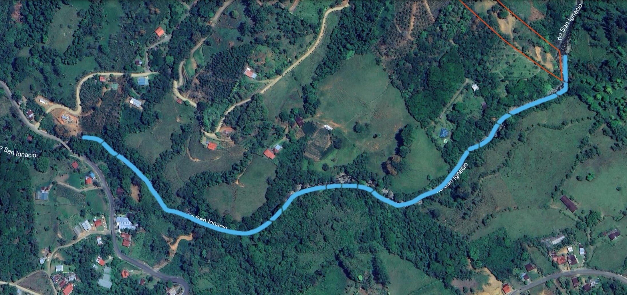 Your land
Swipe or tap a number
03 · Building pads
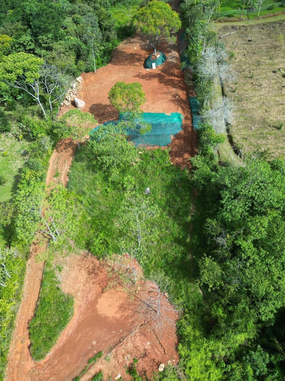
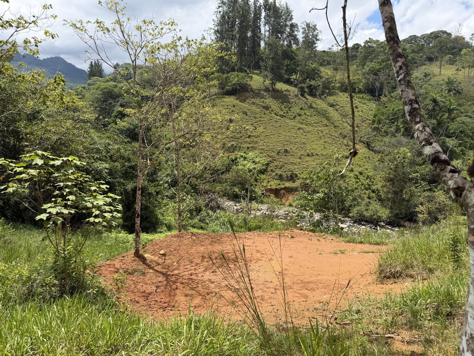
The central pad, in one view
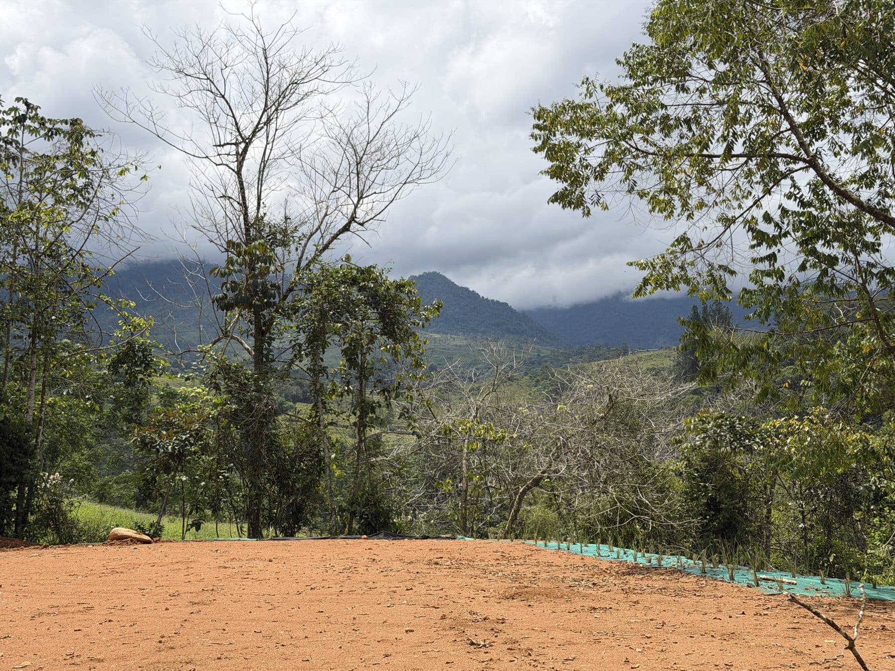
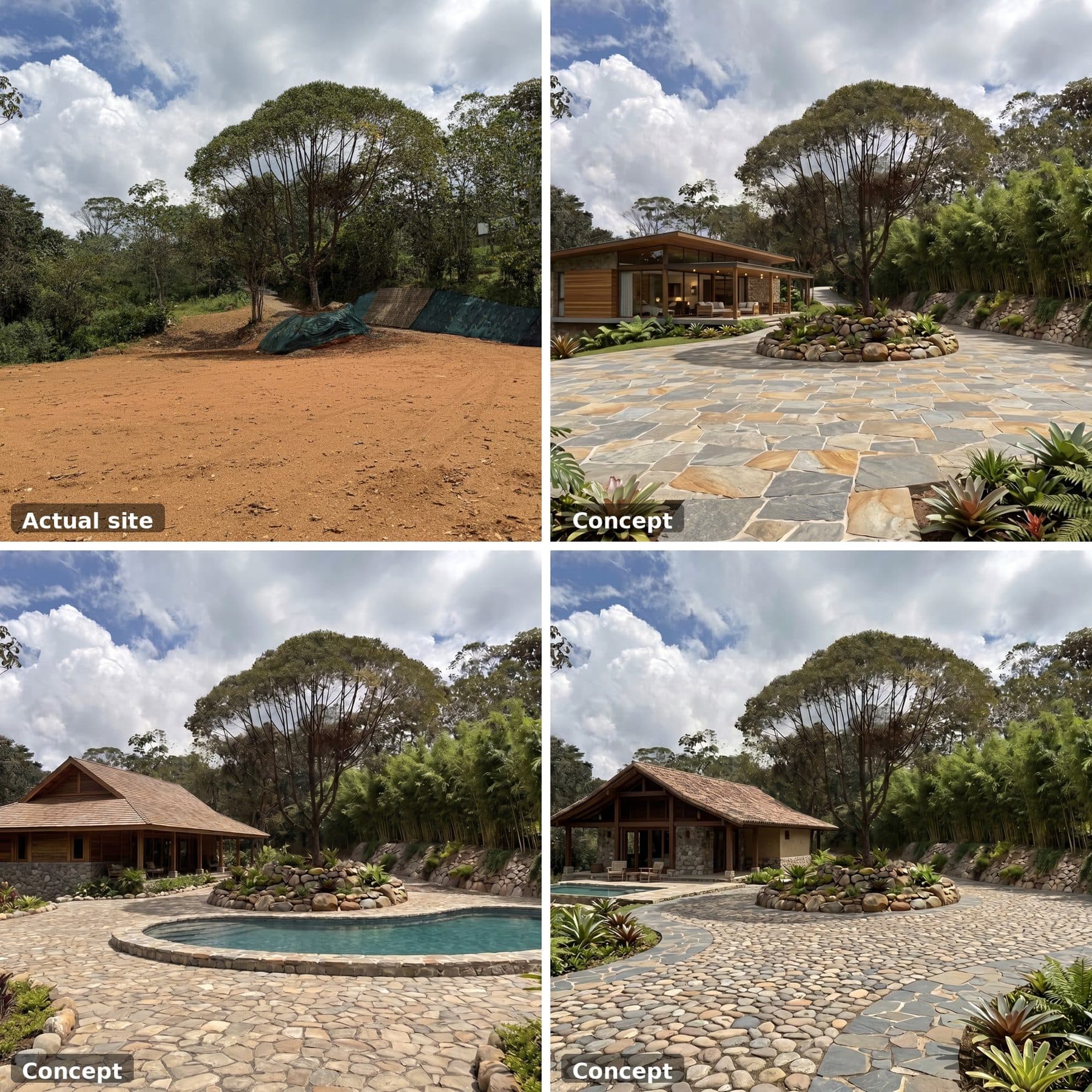
The largest pad, about 1,150 m², leveled and cleared around the mature tree that was kept in the middle. The gravel road ends here.
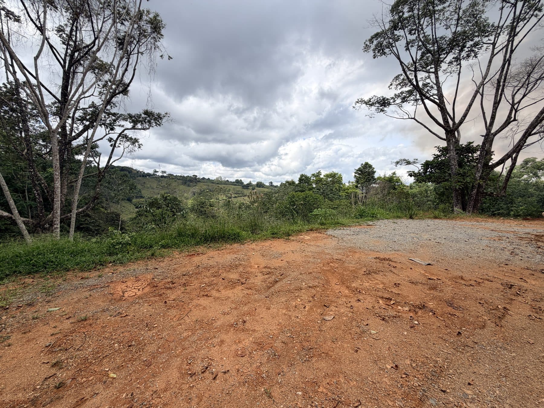
From the ground
Three cleared pads, three settings
Three areas are already leveled and cleared: the easiest places to start, not the only ones. Sizes from the October 2025 survey of the land.
 301 m² · ≈875 m
Upper pad (mountain views)
On the high point near the entrance, at roughly 875 m, with panoramic mountain views across the valley.
≈1,150 m² · ≈855 mCentral pad
The largest platform, mid-property at roughly 855 m, with a mature shade tree kept in the middle. Enlarged to about twice the surveyed area after the Oct 2025 survey. The gravel internal road reaches this pad.
 ≈250 m² · ≈840 m
River pad
Near the river at roughly 840 m, above the protected margin. Enlarged to about twice the surveyed area after the Oct 2025 survey. Ideal for a rancho, studio or guest cabin.
Three areas are already leveled and cleared. The October 2025 topographic survey of the land measured them at 301 m², 582 m² and 128 m²; since then the central pad and the river pad were enlarged to about double. They are the ready-made building spots, not the only ones: the land has room for more. Map positions are approximate. A small additional leveled platform sits just below the upper pad (photo 20); not part of the three surveyed pads.
Included asset
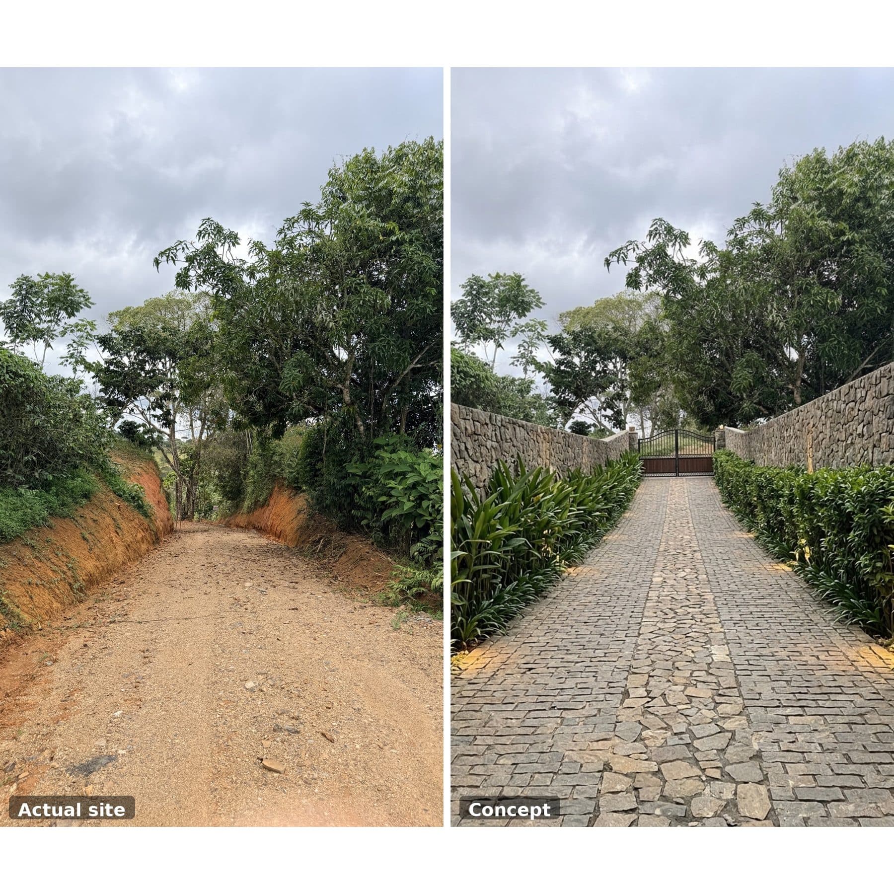
Your own driveway: registered 7 m × 107 m easement
Included asset: a registered 7 m × 107.33 m strip (about 750 m²) over the neighbouring farm, bought in August 2025 and inscribed in the National Registry in favour of this finca. It carries permanent rights of vehicle access, water lines and electrical lines, plus the right to a lockable gate and to plant along it. The neighbour has committed to segregate the strip and transfer it to the owners of Finca 250739 once a surveyor prepares the plano.
04 · What's done
What's already done
The slow, expensive groundwork is finished. You start from plans, not from a jungle.
- Three leveled and cleared building pads (upper 301 m²; central ≈1,150 m² and river ≈250 m², both enlarged since the Oct 2025 survey), with room for more building sites on the land
- Professionally engineered drainage system for slope water management (concrete channel)
- Erosion control (geotextile covers) on the cut slopes
- Electricity meter installed and live at the property frontage
- Internal road through the property down to the river: gravel-surfaced to the central pad, unsurfaced from there to the river
- Own registered 7 m × 107.33 m easement strip over the neighbouring farm, bought in 2025, with permanent rights for vehicle access, water lines and electrical lines, a lockable gate and planting; the neighbour committed to segregate the strip and transfer it to the property
- Topographic survey of the land with 1 m contours and orthophoto (Oct 2025)
- Fluvial setback surveyed and respected
- Land use approved by the municipality (uso de suelo): residential, for a home (vivienda), and for the earthworks (movimiento de tierra)
Still to do
- Water: not yet installed. ASADA (rural water association) serves the area and neighbouring properties are connected, so a connection can be obtained
05 · Location
Where it is
The hills of San Ignacio de Cajón, minutes from Hacienda AltaGracia, 30 minutes from San Isidro de El General.
Drive times
- 7′Well-stocked supermarket
- 18′Cajón center (butcher, shops, services)
- 30′San Isidro de El General / Pérez Zeledón (Walmart, cinema, full services)
- 35′Regional hospital
- 1hPacific beaches of Dominical and Uvita
- 3hSan José and Juan Santamaría International Airport (SJO)
Spring-like mountain climate, comfortable year-round. Cellular coverage and Starlink available.
Two access routes; reachable by a normal 2-wheel-drive vehicle, though a 4x4 is recommended, especially in the rainy season.
Boundary from the cadastral plan (KML). Pad markers are approximate. Switch to satellite to see the river. · Google Maps
06 · Legal
Legal, in plain English
Everything a foreign buyer's lawyer will ask about, laid out up front.
Title
Registered fee-simple title (folio real) in the Costa Rican National Registry, inscribed in the current owners' names on 26 August 2025. No mortgages, liens or annotations (registry consult 16 September 2026).
Finca: San José No. 250739, derechos 001 and 002. Registry nature: Terreno de café (coffee land). Area: 12,571.09 m².
Inscribed. The Registro Nacional shows Peter Hendrik Jan de Harder (right 001) and Joselyn Andrina Romero Mena (right 002) as owners, 50% each, inscription date 26 August 2025 (presentación 2025-00661247-01), no annotations. Verified on rnpdigital.com on 16 September 2026.
Cadastral plan (plano catastrado)
SJ-1179094-2007 · surveyed March 2007 by Gonzalo Mora Fallas, Topógrafo Asociado TA-10302 · inscribed 2007-06-01.
Boundaries per the registry: N: Right-of-way easement (servidumbre de paso) · S: Gerardo Matamoros Mata · E: Rodrigo Zúñiga Córdoba; the river (Río San Ignacio / Río Calientillo) runs along this side · W: Public road (calle pública).
The river is Río San Ignacio on Google Maps and in local use. The 2007 cadastral plan, the 2007 segregation deed and the Oct 2025 topographic survey label the same watercourse on the east boundary 'Río Calientillo'. Both names refer to the river along the property's lower (east) boundary.
Easements and access
The property holds permanent registered easements over the neighbouring farm (Finca 590398) for vehicular access, water lines (acueducto) and electrical lines, 7 m wide and 107.33 m long, running east–west, per public deed No. 78 (Notary José Pablo Rivera García, 22 August 2025). Utility companies may enter the easement to install and maintain services. The owners of Finca 250739 may build a lockable gate and plant trees, shrubs and hedges along the easement. The neighbour committed to segregate the easement strip and transfer it to the owners of Finca 250739 once a surveyor prepares the plano.
Forestry Law 7575, Article 33: the river setback
Costa Rica's Forestry Law protects a strip of land along every river and stream. Along rivers in rural areas the protected strip is 15 metres measured horizontally from each bank on flat land, or 50 metres on steep (quebrado) land; springs get a 100 m radius. You cannot build inside that strip, but you fully own it and can use it for trails, gardens, and access to the water. Because Finca 250739 has river frontage, the plano notes that it is 'affected by' Article 33. This is normal for any riverfront parcel in Costa Rica. The Oct 2025 topographic survey marks a 15 m creek setback at the river end of the property, and all three building pads sit outside it, well above the river.
No spring registered with the Dirección de Agua lies within 100 m of the boundary; the nearest is about 700 m away.
Land use (uso de suelo)
The Municipalidad de Pérez Zeledón has approved two land uses for this parcel, both with resolution CONFORME under the rural zoning of the Plan Regulador: residential use for a home (vivienda) and the earthworks (movimiento de tierra). Front setback 2 m, minimum frontage 40 m. A buyer requests a certificate for their own project, a routine municipal step on unchanged zoning; a building permit is obtained separately.
What shows on the registry
- Reservas y restricciones (Ley de Aguas / Ley de Caminos) — Standard legal reservations that appear on virtually every rural Costa Rican title. They preserve the State's rights under the water and roads laws and do not restrict ordinary residential use.
- Servidumbre de paso (2007 segregation), 107.33 m × 7 m, west to east, in favour of Finca 590396 — Created 17 Dec 2007 in favour of one of the segregated lots. Appears as an encumbrance of record; it corresponds to the shared access strip and does not affect the building areas.
- Easements IN FAVOUR of this property over Finca 590398 (deed No. 78, 22 Aug 2025) — Permanent easements for vehicular access, water lines and electrical lines, 7 m × 107.33 m, running east to west, in favour of Finca 250739 and against Finca 590398. This is the property's private driveway to the public road. Registered and visible in the National Registry.
Buying as a foreigner
Foreigners can own titled land in Costa Rica with the same rights as citizens (this is not maritime-zone or concession land). The sale is signed before a Costa Rican notary public, who registers the transfer in the National Registry.
Sold as-is. ≈ US$21 per m² · ≈ US$83,000 per acre.
Due diligence: This summary was prepared from the registry certification, cadastral plan, land-use certificate and public deed. Your attorney should independently verify the current registry status (estudio de registro) as part of standard due diligence.
07 · Contact
Ask a question or request a viewing
I reply personally, usually within a day.